

How long was it called Dudley Square anyway?
When did the junction of Washington and Dudley Streets in Roxbury officially become “Dudley Square”?
Thomas Dudley, four-time Massachusetts Governor and frequent Lieutenant Governor, arrived in 1630 with John Winthrop’s Arbella fleet, originally founding Cambridge. Dudley moved across the river to Roxbury in 1634 where the core of the Dudley estate was anchored at Dudley’s manor house, which would have sat approximately on today’s Guild Row. The grounds stretched south to Bartlett Street and west towards the current site of the First Church of Roxbury. In 1776, the mansion was dismantled as the Continental Army required the raw material. In 1810, we know a Dudley still owned property on the old estate as a parcel was donated/sold to build Roxbury’s first Town Hall at the corner of Dudley and Putnam Streets, marking a 176-year Dudley occupation. A decade later, a Universalist church would be built on the site of the old Dudley home.
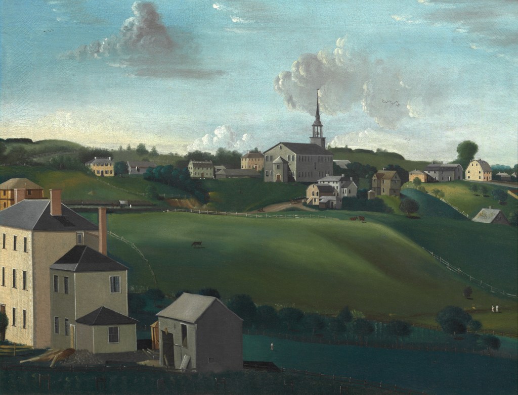
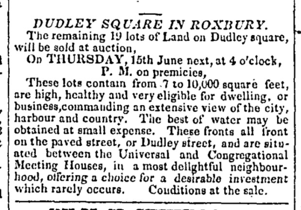
The earliest reference I can find to Dudley Square is an 1826 real estate ad for property in Dudley Square “between the Universal and Congregational Meeting Houses” which is describing the property currently between[MAP] the First Church/Putnam St and Guild Row/Nubian Station.
At an 1894 meeting of the Dudley Family Association, secretary of the association Dudley Childs notes that ‘[b]y recent action of the [Boston] Board of Aldermen, the name Dudley Square has been given to the space at the intersection of Washington and Dudley streets, at Guild Row, in Roxbury, adjoining the site of Gov. Thomas Dudley’s house.”
Prior to 1910, Boston’s legislative branch was bi-cameral. While the Aldermen voted to codify the Dudley Square name in 1894, the other legislative body, the Common Council, took it up twice more, first on May 20, 1909, proclaiming the intersection “Governor Dudley Square”:

And then in January of 1910, Mr. Hackett reversed himself, motioning to re-name Governor Dudley Square as Edward Everett Hale Square after the local minister. Hackett was petitioned by local clergy for the name change and he argues that no one really knows the area as Dudley Square, that there is no signage proclaiming it as Dudley Square, and it’s only officially been Dudley Square for a few months. The other council members called baloney noting that it had been known as Dudley Square for a “generation” and people don’t need a sign to know what a landmark is named. Furthermore, it’s not good sense to change the name when people already know it as Dudley Square. The motion did not pass.

Although modern Bostonians don’t know it as Governor Dudley Square, this moniker makes sense in early 1900s context, as we learn from city records and historical maps[MAP] that Roxbury also featured Governor Eustis Square[MAP] and Governor Shirley Square[MAP], named for other Roxbury-based Massachusetts Governors. Although there still exists a designated Governor Shirley Square Historic District, Eustis Square lost one of its feeder streets to development, and Shirley Square doesn’t appear on modern maps. It’s easy to postulate that the durability of the Dudley Square name is due to its centrality as a hub of culture and commerce and that it shared a name with a major transportation hub for 118 years.
Governor Dudley Square became Nubian Square in December of 2019 after years of local advocacy. While some prominent Roxbury residents opposed the name change, Yawu Miller notes in the Bay State Banner that there was no organized effort supporting retention of the Dudley name. A few months later, the MBTA followed suit renaming the bus terminal Nubian Station. Read more of Miller’s Banner article here.

(Published 09/07/2021)
Additional sources
Drake, F. S. (Francis Samuel). (1878). The town of Roxbury: its memorable persons and places, its history and antiquities, with numerous illustrations of its old landmarks and noted personages. Roxbury.
Glimpses of Early Roxbury: General Society of the Daughters of the Revolution. Massachusetts. Mary Warren Chapter, Roxbury (1905).Boston
Thwing, W. Eliot. (1908). History of the First Church in Roxbury, Massachusetts, 1630-1904. Boston: W. A. Butterfield.
Vital Records of Roxbury, Massachusetts, to the End of the Year 1849. (1925). United States: Essex institute.
Atlascope Boston, Norman B. Leventhal Map & Education Center at the Boston Public Library
All other sources are linked or noted in the text.
SUBSCRIBE TO MY NEWSLETTER: https://elevennames.substack.com/


Copyright Wayne Tucker 2024. This work is licensed under a Creative Commons Attribution-NonCommercial 4.0 International License
